
Ellesmere Island
Canada's northernmost island, mountainous and sparsely populated.

via Wikipedia: Ellesmere Island · see source
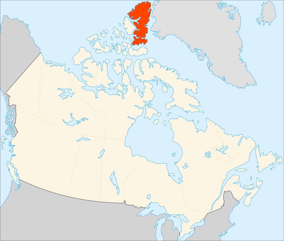
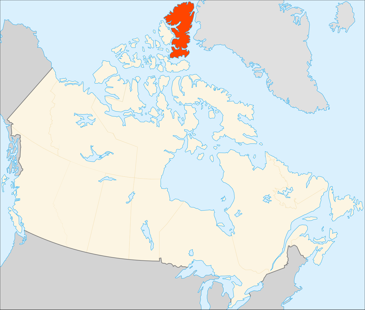
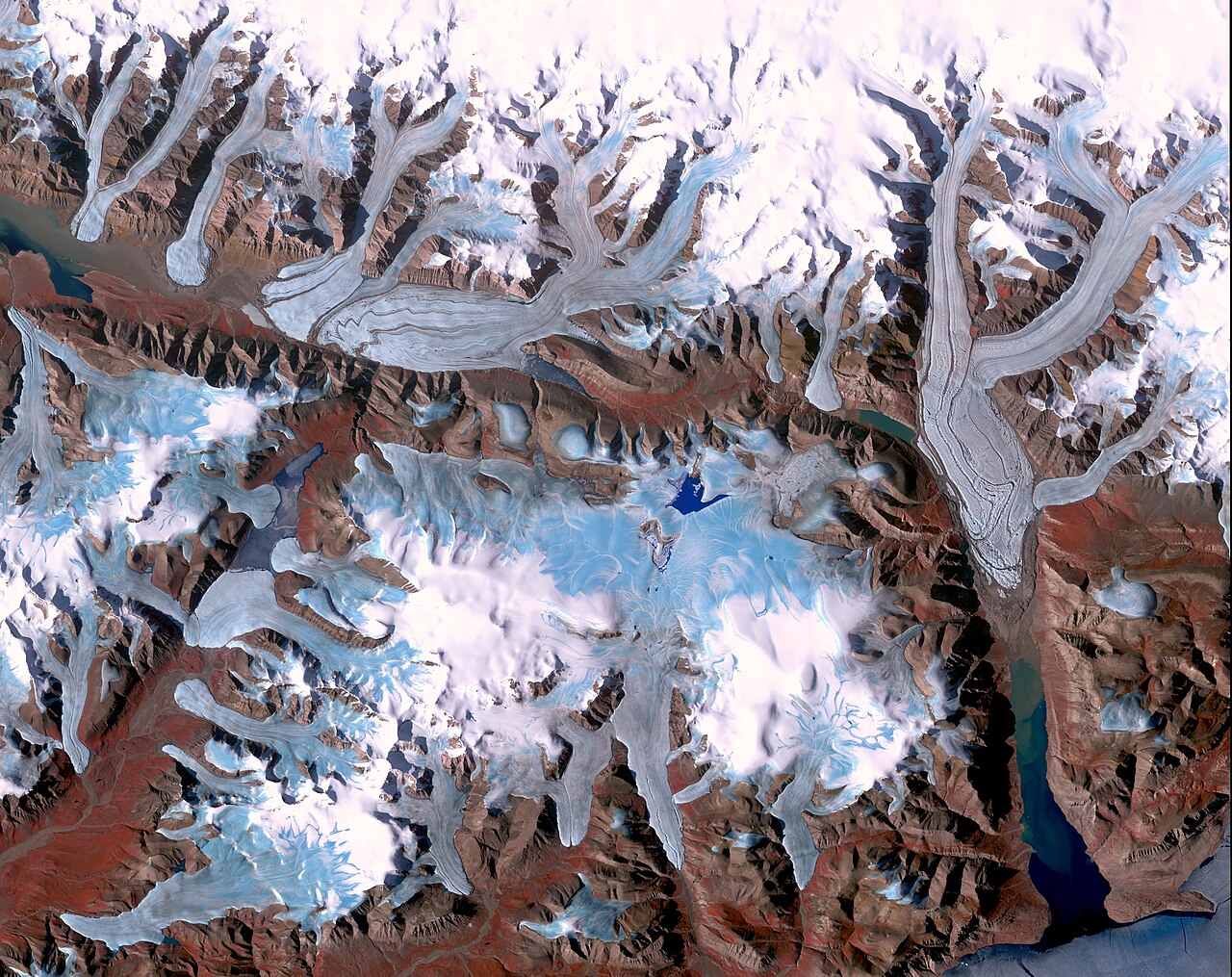
Ellesmere Island is Canada's northernmost and third largest island, and the tenth largest in the world. It comprises an area of 197,790.33 km² (76,367.27 sq mi), slightly smaller than Great Britain, and the total length of the island is 830 km (520 mi). Lying within the Arctic Archipelago, Ellesmere Island is considered part of the Queen Elizabeth Islands. The Arctic Cordillera mountain system covers much of Ellesmere Island, making it the most mountainous in the Arctic Archipelago. More than one-fifth of the island is protected as Quttinirpaaq National Park. In 2021, the population of Ellesmere Island was recorded at 144 in three settlements: Alert, Eureka, and Grise Fiord.
- highest_point
- Barbeau Peak (2,616 m or 8,583 ft)
Verified Timeline
Lore & Background
Ellesmere Island has three major geological regions: the Grant Land Highlands, a belt of fold mountains part of the Franklinian mobile belt; the Greely-Hazen Plateau, a tableland of sedimentary and volcanic rocks; and a coastal sedimentary plateau covering most of the island, part of the Franklinian Shield with an extension of the Canadian Shield. A period of uplift and faulting prior to the Pleistocene epoch established the island's overall features, with additional uplift from isostatic rebound after the Last Glacial Period. Land features were shaped by erosion from glacial ice, meltwaters, and scouring by sea ice. Pre-contact peoples migrated through the High Arctic from the south and west, traveling along Ellesmere's coasts or overland to Nares Strait, with some crossing to Greenland. The Arctic Small Tool tradition peoples (Paleo-Eskimos) hunted chiefly muskoxen in the Eureka Upland and Hazen Plateau, with six different small-tool cultures identified at Smith Sound. The Thule culture moved into the High Arctic around 1000 CE, with a major population centre at Smith Sound. They completely replaced the Dorset after 1300 CE, having technological advantages including effective weapons, kayaks, umiaks, and sled dogs. More than fifty Norse artifacts have been found in Thule sites on the Bache Peninsula, dating from c. 1250 to 1400 CE, though it is uncertain if Ellesmere was directly visited by Norse Greenlanders or if items were traded. Between 1400 and 1600 CE, the Little Ice Age forced the Thule to withdraw from Ellesmere. European exploration began with William Baffin's 1616 expedition, which recorded sighting the island. In 1852, Edward Augustus Inglefield named Ellesmere Island for Francis Egerton, 1st Earl of Ellesmere. The search for Franklin's lost expedition involved more than forty expeditions over two decades. As the Little Ice Age abated, Indigenous peoples returned, including the journey of Qitlaq, who led Inuit families from Baffin Island to northwestern Greenland via Ellesmere in the 1850s.
Reader's Guide
Ellesmere Island holds significance as Canada's northernmost landmass and a key location in the Arctic Archipelago. Its geological diversity—from the Grant Land Highlands to the coastal sedimentary plateau—reflects a complex history of uplift, faulting, and glacial erosion. The island's archaeological record provides a remarkably complete view of pre-contact Arctic cultures, with artifacts preserved by cold, dry winds and permafrost. The presence of six small-tool cultures and later Thule settlements, along with Norse artifacts, illustrates a long history of human migration, trade, and adaptation to extreme environments. The island's role in European exploration, particularly during the search for the Northwest Passage and Franklin's lost expedition, underscores its importance in Arctic history. Today, with a population of 144 in three settlements and much of its area protected as Quttinirpaaq National Park, Ellesmere Island remains a vital site for scientific research and cultural heritage.
Did You Know?
- Cape Columbia, at 83°06′41″N 69°57′13″W, is the most northerly point of land in Canada and one of the most northern points of land on the planet.
- As of 2025, the north geomagnetic pole is located on Ellesmere Island at 80°51′N 72°46′W.
- More than fifty Norse artifacts, including pieces of chain mail, have been found in Thule archaeological sites on the Bache Peninsula.
- The Thule culture completely replaced the Dorset culture on Ellesmere some time after 1300 CE.
- The journey of Qitlaq in the 1850s reestablished contact between Inuit who had been separated for two centuries.
Geography & Physical Landscape
As Canada's northernmost and third-largest island, it ranks tenth in size worldwide and sits within the Queen Elizabeth Islands of the Arctic Archipelago. Its most northerly point, Cape Columbia, marks the farthest landmass in Canada and one of the most extreme points of land on Earth. The island is also home to the north geomagnetic pole, which as of 2025 sits at roughly 80°51′N. The Arctic Cordillera dominates the landscape, giving Ellesmere the distinction of being the most mountainous landmass in the entire Arctic Archipelago. Geologically, the island divides into three major regions: the Grant Land Highlands of folded Cretaceous-era rock in the north, the Greely-Hazen Plateau of sedimentary and volcanic tableland in the centre, and a vast coastal sedimentary plateau of highly eroded peaks that covers most of the remaining area. Uplift and faulting before the Pleistocene established the island's broad shape, while isostatic rebound after the Last Glacial Period raised the land further. Glacial ice, meltwaters, and sea-ice scouring then carved the terrain into its present form.
Indigenous Cultures & the Arctic Small Tool Tradition
Long before European contact, the High Arctic was home to small, mobile hunting bands known as Paleo-Eskimos. The Independence I culture was active as far back as 2700 BCE, and six distinct small-tool traditions have been identified in the Smith Sound region alone. On Ellesmere, these peoples concentrated their hunting in the Eureka Upland and Hazen Plateau, primarily targeting muskoxen. More than three-quarters of their known sites lie in the island's interior, and their winter shelters were portable skin tents, reflecting a lifestyle built around following herds. Evidence at Lake Hazen reveals a trade network operating around 1500–1000 BCE, with soapstone lamps arriving from Greenland and incised lance heads coming from cultures to the south. The Thule people arrived during a warming period around 1000 CE, establishing their major population centre in the Smith Sound area. They possessed technological advantages—effective weapons, kayaks, umiaks, and sled dogs—that allowed them to fully replace the Dorset culture after 1300 CE. Their trade networks carried meteoritic iron from Greenland through Ellesmere to the broader archipelago and the North American mainland.
Norse Encounters & the Long Silence
More than fifty Norse artifacts have been recovered from Thule archaeological sites on the Bache Peninsula of Ellesmere Island, including fragments of chain mail. A bronze set of scales found in the western part of the island has been interpreted as evidence of a Norse trader operating in the region. These items date from roughly 1250 to 1400 CE, yet the precise mechanism of their arrival remains debated. It is possible that Norse Greenlanders sailed directly from the south, or that the objects moved through a chain of middlemen, or even that they were salvaged from a shipwreck. The story takes a darker turn with the onset of the Little Ice Age between 1400 and 1600 CE. As hunting conditions deteriorated, the Thule withdrew from Ellesmere and the other northern islands of the archipelago. Those who remained in northern Greenland became increasingly isolated, narrowed their diet to a diminishing range of game, and eventually lost the capacity to build boats. The waters surrounding Ellesmere fell into a navigational silence that would last until large European vessels appeared after 1800, marking the beginning of a new era of exploration centred on the search for the Northwest Passage.
Modern Presence & Conservation
Today, Ellesmere Island is among the most sparsely inhabited places on Earth. In 2021, its entire population numbered just 144 people spread across three settlements: Alert, Eureka, and Grise Fiord. Administratively, the island falls within the Qikiqtaaluk Region of the Canadian territory of Nunavut. Despite its remoteness, the island holds extraordinary scientific and conservation significance. More than one-fifth of its area is set aside as Quttinirpaaq National Park, protecting the dramatic peaks of the Arctic Cordillera and the fragile tundra ecosystems that cloak them. The island also hosts the north geomagnetic pole, a position that shifts over time but which as of 2025 sits at approximately 80°51′N, 72°46′W, making the land a natural laboratory for geomagnetic research. The Arctic's cold, dry climate and extensive permafrost have turned the island into an open-air archive. Artifacts left or lost thousands of years ago remain in near-original condition—freeze-dried by the wind or preserved beneath frozen ground—allowing archaeologists to read the material record of successive cultures with remarkable clarity, even though only a small fraction of excavation details has been published.
Gallery
Frequently Asked Questions
Who is Ellesmere Island?
Ellesmere Island is Canada's northernmost landmass and its third-largest island, ranking tenth globally by area. It sits within the Arctic Archipelago and is grouped under the Queen Elizabeth Islands.
What are Ellesmere Island's key physical features?
The Arctic Cordillera mountain range dominates the terrain, making it the most mountainous island in the entire Arctic Archipelago. Its summit, Barbeau Peak, reaches 2,616 m (8,583 ft).
How big is Ellesmere Island compared to familiar places?
It spans roughly 197,790 km² (76,367 sq mi) and stretches about 830 km (520 mi) end to end, making it just slightly smaller than Great Britain.
What special geographic distinction does Ellesmere Island hold as of 2025?
The north geomagnetic pole is currently situated on the island, a position that shifts over time as Earth's magnetic field changes.
Why is Ellesmere Island important and how protected is it?
Nearly one-fifth of its area is set aside as protected land, and it remains sparsely populated, preserving one of the most remote and rugged Arctic environments on Earth.
More in Islands And Archipelagos 1-24
Elsewhere in the Islands And Archipelagos universe
Spotted an error? Know more?
This is a living reference — every entry is fact-audited, and reader corrections feed straight into our audit queue. Suggest an edit · See this site's audit record